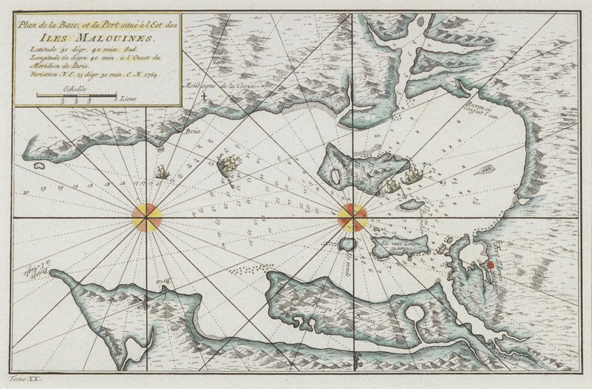
This map shows the northeastern part of East Falkland, the largest of the Falkland Islands, located in the South Atlantic Ocean. More specifically, it shows the inner cove of an inlet called Berkeley Sound. To the right of the map, marked by a red dot, is Port Louis, also known as Puerto Soledad or Port Solitude, which was originally established as a French colony under the name Port Saint Louis.
In 1763-64 French navigator and military commander Louis Antoine de Bougainville founded the first settlement on Berkeley Sound, at present-day Port Louis. French traveller and writer Antoine-Joseph Pernety took part in the expedition. Pernety later published his ‘Journal Historique d'un Voyage fait aux îles Malouines’. This map of the islands was published as an illustration to the work.
The map was sent to Margaret Thatcher in 1987 as a gift by an admirer in Malmo, Sweden, who congratulated Thatcher for her success in the Falklands Conflict of 1982. The Prime Minister replied personally, expressing her gratitude: ‘I cannot thank you enough for your very kind gift… [and] your good wishes which are very much appreciated.’ The work remained on display at Downing Street until 1995.