Map of England
-
About the work
- Location
-
Country: UK
City: London
Place: Government Art Collection
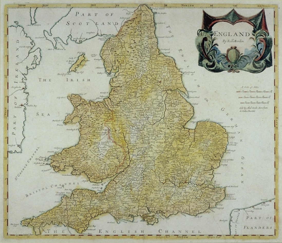
This detailed map, titled ‘ENGLAND’, in fact includes Wales as well as outline drawings of parts of Ireland, Scotland and Flanders. England, Ireland and the Isle of Man have been hand-coloured with washes of yellow and green watercolour.
-
About the artist
Robert Morden was a maker of maps and globes. Nothing is known of his background but he is thought to have been apprenticed to the printer and globe maker Joseph Moxon early in his career. Morden frequently advertised in the ‘London Gazette’ and at times went into partnerships with fellow mapmakers, including William Berry and Philip Lea. His best known maps were for Edmund Gibson’s 1695 edition of ‘Camden's Britannia’. In addition he produced maps of London, Essex, the American colonies, parts of Europe and a 13-sheet map of the world. He also dealt in mathematical instruments and wrote publications, including ‘Geography Rectified’ (1680) and ‘An Introduction to Astronomy, Geography, Navigation, and other Mathematical Sciences’ (1702).
-
Explore
- Places
- England
- Subjects
- map (as Subject), cartouche
- Materials & Techniques
- engraving, coloured engraving
-
Details
- Artist
-
Robert Morden
- Title
- Map of England
- Date
- c.1700
- Medium
- Coloured engraving
- Acquisition
- Presented by Dr. Peter Rusk, November 1971
- GAC number
- 9548