Descriptio Regni Tunetani
-
About the work
- Location
-
Country: Tunisia
City: Tunis
Place: British Embassy
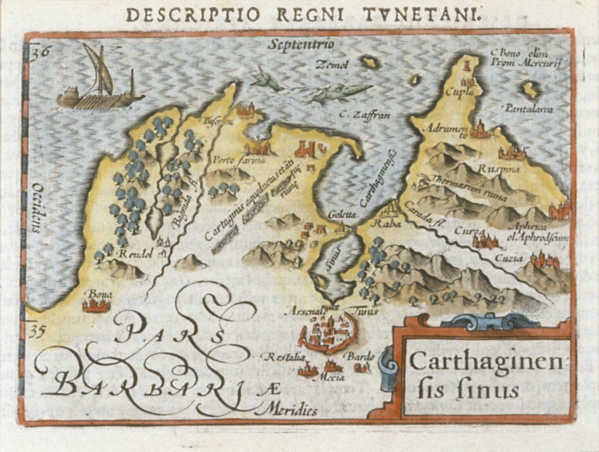
This engraving depicts a brightly coloured miniature antique map of ‘the kingdom of Tunisia’, and in particular the gulf of Carthage, as the red and blue decorative cartouche informs us. It was made by Petrus Bertius and published in c. 1606. The borders are highlighted in yellow and landmarks such as aqueducts, ancient ruins and ports are clearly marked or drawn with red on the map. Important fortifications such as La Goletta, the strongest marine city in Tunisia, and Annaba (formerly known as Bona), a seaport city in Algeria, also feature on the map. A boat can be seen sailing along the Gulf of Tunis on the top right hand corner of the map, while a shark emerges from the water.
In his atlas ‘Tabularum Geographicarum Contractarum Libri Septem’ published in Amsterdam in 1618, Bertius included a map and a description of the Kingdom of Tunisia and highlighted in particular the ancient Roman triumphal arches and temples. He also quotes a poem by the great 16th-century Dutch humanist Joseph Scaliger in which he laments the destruction of the monuments of ancient Carthage. During this period, scholars in Northern Europe were focused on Reformation and the reinterpretation of Christianity as well as studying and reviving classical sources. -
Explore
- Subjects
- map (as Subject), seascape/coastal scene, townscape/cityscape, mountain, sea, ship
- Materials & Techniques
- engraving, coloured engraving
-
Details
- Artist
-
Petrus Bertius (1565 - 1629)
- Title
- Descriptio Regni Tunetani
- Date
- c1606
- Medium
- Coloured engraving
- Dimensions
- height: 11.40 cm, width: 19.20 cm
- Acquisition
- Origin uncertain
- Provenance
- Foreign & Commonwealth Office (British Embassy, Tunis)
- GAC number
- 17667